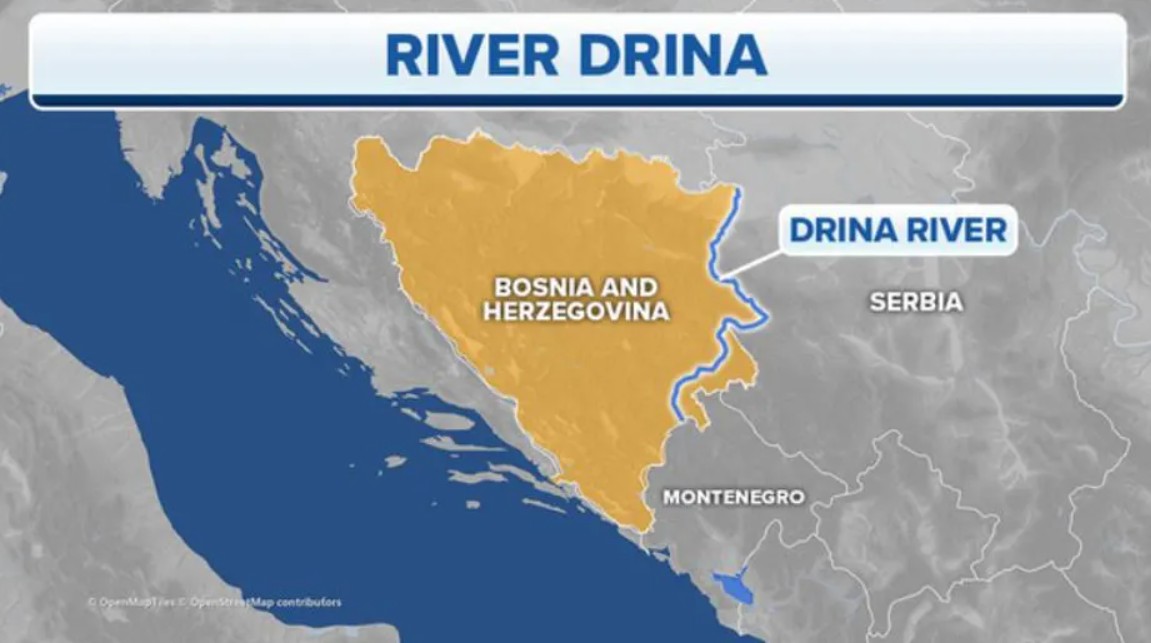
The Drina River
About Drina river
Length: 346 km
Region: Balkans (Southeast Europe)
Countries involved:
Bosnia and Herzegovina
Serbia
Montenegro (source region)
The Drina River forms a major part of the international boundary between:
Bosnia and Herzegovina
Serbia
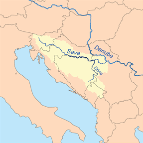
River system and drainage
The Drina is:
The longest tributary of the Sava River
Part of the Danube River drainage basin
Flow hierarchy:
Drina → Sava → Danube → Black Sea
Source and origin
The Drina originates from the confluence of two rivers:
Tara River
Piva River
Location of confluence:
Between Šćepan Polje (Montenegro) and Hum (Bosnia and Herzegovina)
Physiographic setting:
Glen between the slopes of:
Maglić
Hum
Pivska Planina
Physiographic significance
The Drina is the longest karst river of the Dinaric Alps.
Karst characteristics:
Flow through limestone terrain
Presence of gorges, underground channels, and steep valleys
Mountain system:
Dinaric Alps

Q. The Drina River is a tributary of which of the following rivers?
A. Danube
B. Tisza
C. Sava
D. Morava
Correct answer: C
Explanation:
The Drina flows into the Sava River, which later joins the Danube.
Q. The Drina River is formed by the confluence of:
A. Morava and Vardar
B. Tara and Piva
C. Sava and Danube
D. Lim and Ibar
Correct answer: B
Explanation:
The Tara and Piva rivers originate in Montenegro and meet near Šćepan Polje and Hum to form the Drina.
Q. With reference to the Drina River, consider the following statements:
It forms part of the border between Bosnia and Herzegovina and Serbia.
It belongs to the Danube River drainage basin.
It originates entirely within Serbia.
Which of the statements given above are correct?
A. 1 and 2 only
B. 2 and 3 only
C. 1 and 3 only
D. 1, 2 and 3
Correct answer: A
Explanation:
Statement 1: Correct
Statement 2: Correct
Statement 3: Incorrect – it originates at the Montenegro–Bosnia border.