Issue with the Map of Africa and the Mercator Projection
Background
-
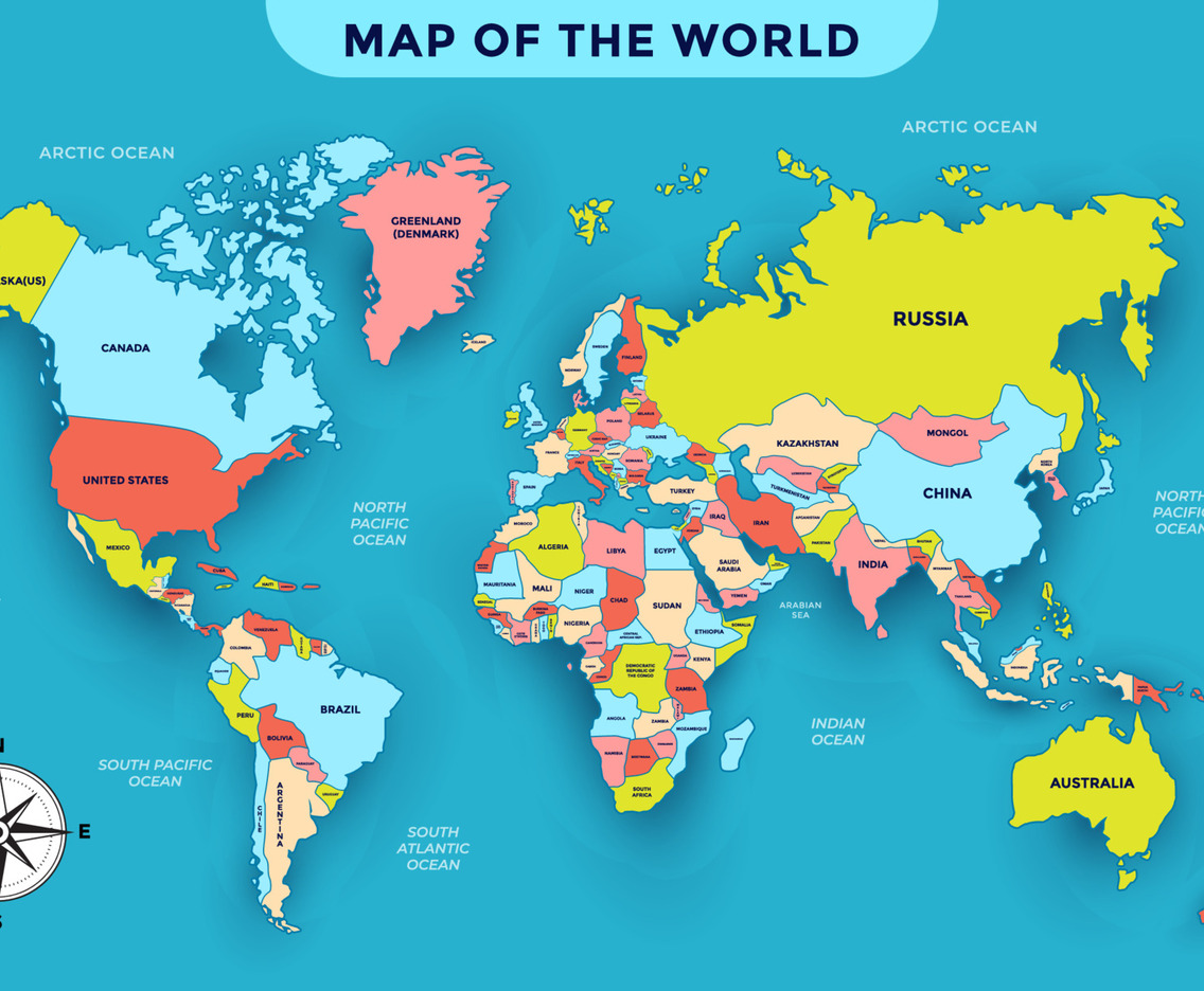
The Mercator projection (1569, Gerardus Mercator) was designed for navigation, not accuracy of landmass sizes.
-
It distorts scale near the poles, making Europe, Russia, Canada, and Greenland look much larger than they are, while shrinking equatorial regions like Africa, South America, and India.
-
Example: Africa (30 million sq. km) often appears the same size as Greenland (2.1 million sq. km), though Africa is 14 times larger.
Why Africa is Concerned
-
The African Union (AU) has endorsed the “Correct the Map” campaign to replace the Mercator projection.
-
The distortion has long contributed to symbolic marginalisation of Africa, making it appear smaller and less significant.
-
Critics argue the map reinforced colonial attitudes — Africa looked “small and conquerable then, irrelevant now.”
-
Textbooks, media, and online platforms still widely use the Mercator projection, reinforcing stereotypes.
Why Maps are Distorted
-
Flattening a spherical Earth onto a rectangle always requires compromise.
-
A map can preserve area, shape, distance, or direction — but not all simultaneously.
-
Mercator preserved shape and angles (good for navigation) but sacrificed area accuracy.
Alternatives
-
Equal Earth Projection (2018):
-
Preserves relative areas, showing Africa’s true size.
-
Continents look slightly curved or stretched.
-
-
Gall-Peters Projection (1970s):
-
Area-accurate but elongated vertically.
-
Politically motivated correction to Mercator.
-
-
Orthographic Projection:
-
Earth as seen from space; visually intuitive.
-
Limitation: shows only one hemisphere at a time.
-
-
Other Corrective Maps:
-
e.g., Stuart McArthur’s 1979 “Universal Corrective Map,” which flipped the world upside down.
-
What Lies Ahead
-
Institutional change is difficult: Mercator is deeply entrenched in classrooms, digital platforms, and atlases.
-
Adoption efforts:
-
AU backing adds legitimacy.
-
World Bank, National Geographic, NASA already using Equal Earth.
-
Google Maps offers a 3D globe (desktop), but defaults to Mercator on mobile.
-
-
Requires curriculum reform, digital redesigns, and mindset shifts to correct historical biases.