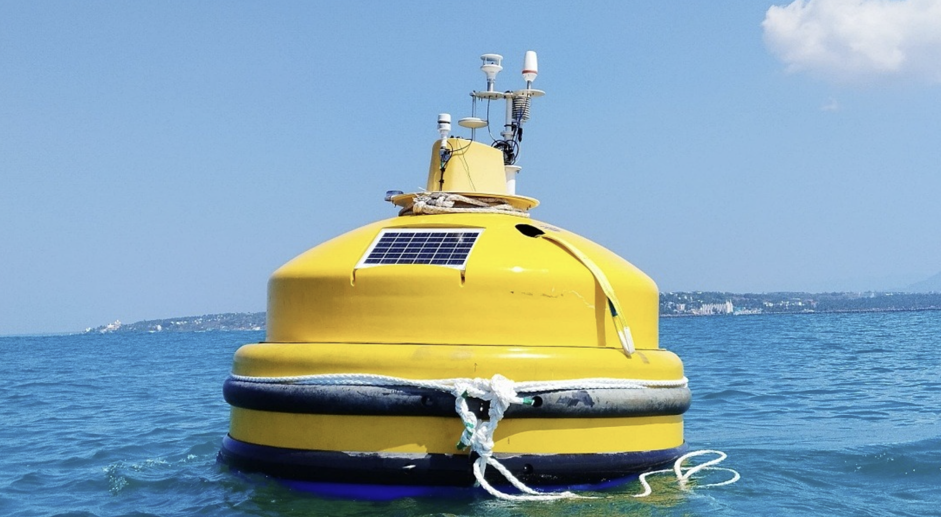
Floating LiDAR Buoy System
What is it?
A high-tech ocean-based instrument used to measure wind conditions over the sea
Integrates:
Floating buoy platform
LiDAR (Light Detection and Ranging) technology
Developed by
National Institute of Ocean Technology (NIOT)
Tested off Muttom coast, Tamil Nadu
Working principle
Emits laser pulses into the atmosphere
Pulses reflect off aerosols/air particles
Returned signals are analysed to determine:
Wind speed
Wind direction
Vertical wind variation
Key features
Measures wind profiles up to 300 m above sea level
Provides real-time, high-precision data
Works in remote offshore regions
Captures vertical wind structure (important for energy studies)
Advantages over traditional systems
No need for fixed offshore towers
More flexible and mobile deployment
Higher accuracy and vertical coverage
Reduces dependence on imported technology
Applications
1. Weather and disaster management
Improves weather forecasting
Enhances cyclone tracking
2. Renewable energy
Critical for offshore wind energy planning
Helps identify optimal turbine locations
3. Climate studies
Studies ocean–atmosphere interactions
Tracks climate variability
Prelims Practice MCQs
Q. Consider the following pairs:
Institution | Headquarters | Ministry |
1. NIOT | Chennai | Ministry of Earth Sciences |
2. INCOIS | Hyderabad | Ministry of Earth Sciences |
3. IMD | New Delhi | Ministry of Earth Sciences |
Which of the pairs given above are correctly matched?
(a) 1 and 2 only
(b) 2 and 3 only
(c) 1 and 3 only
(d) 1, 2 and 3
Answer: (d) 1, 2 and 3
Explanation:
NIOT → Chennai → Ministry of Earth Sciences (Correct)
INCOIS → Hyderabad → Ministry of Earth Sciences (Correct)
IMD → New Delhi → Ministry of Earth Sciences (Correct)
All three institutions are correctly matched with both their Headquarters and Ministry.
Q. With reference to the Floating LiDAR Buoy System, consider the following statements:
It can capture wind data up to 300 metres above sea level.
It is useful for offshore wind energy planning.
It can only be deployed near the shoreline.
Which of the statements given above is/are correct?
(a) 1 and 2 only
(b) 2 and 3 only
(c) 1 only
(d) 1, 2 and 3
Answer: (a) 1 and 2 only
Explanation:
Statements 1 and 2 are correct. The system can capture wind profiles up to 300 metres above sea level and is valuable for offshore wind power projects. Statement 3 is incorrect because one of its major advantages is operation in remote marine areas, not just near the shore.