Odisha: 50,000 people affected by flash flood in Subarnarekha river
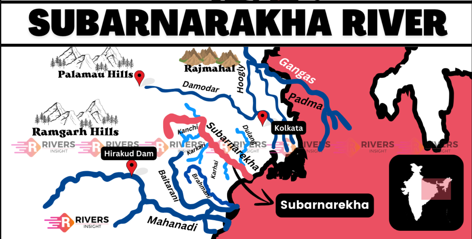
Subarnarekha River
Overview
-
Length: 395 km
-
States Covered: Jharkhand, West Bengal, Odisha
-
Origin: Near Piska/Nagri, Ranchi district, Jharkhand (~600 m elevation)
-
Drainage: Flows into the Bay of Bengal near Talsari, Odisha
-
River Basin Area: ~18,951 sq km
-
Known As: “Golden Line” or “Streak of Gold” (due to gold traces in its sands)
Etymology
-
‘Subarna’ means gold, ‘Rekha’ means line or streak in several Indian languages.
-
Legend: Gold particles were found in the sandy riverbed near the source (Piska village).
-
Even today, locals search for gold in its sands.
Course
-
Jharkhand: Ranchi, Seraikela Kharsawan, East Singhbhum
-
West Bengal: Paschim Medinipur (~83 km stretch)
-
Odisha: Balasore district (~79 km stretch)
-
Important Cities Along Its Path: Ranchi, Jamshedpur, Chaibasa, Bhadrak, and Talsari
Major Tributaries
-
Right Bank: Kharkai, Kanchi, Karru, Raru, Karkari, Roro, Garra, Gurma, Chinguru
-
Left Bank: Dulunga, Khaijori, Damra, Harmu Nadi, Singaduba, Kodia
-
Notable Confluence: Domuhani (Sonari, Jamshedpur) – meeting point of Subarnarekha and Kharkai
Landmarks and Scenic Spots
-
Hundru Falls: Located near Ranchi; water falls from ~98 meters, forming a major tourist attraction.
-
Chandil Dam: Scenic location near Jamshedpur; adjacent rock inscription museum.
-
Bhavnatha Mahadev Temple: On its banks, a spiritual hub dedicated to Lord Shiva.
-
Chhotanagpur Plateau: Through which the river flows, known for rich mineral reserves.
Environmental and Disaster Relevance
-
Flash Flood : Affected ~50,000 people in Balasore (Odisha) due to sudden water release from Chandil Dam following heavy rains in Jharkhand.
-
Climate Change: Affects rainfall patterns and water levels, increasing flood risks.
-
Pollution:
-
Mining of copper and uranium ores in Jharkhand contaminates the river.
-
Industrial discharge, especially from Muri aluminium factory, adds to the pollution.
-
Adverse impact on tribal communities, aquatic life, and agriculture.
-
Importance for UPSC Prelims
-
East-flowing Peninsular River, not Himalayan or snow-fed
-
Hundru Falls – frequently asked static geography question
-
Chandil Dam – often in news (flood control and tourism)
-
Tristate Flow – Jharkhand, West Bengal, Odisha
-
Confluence Point Domuhani – important physical geography location
-
Pollution and tribal livelihood – relevant to Environment & Society questions